
Introduction to Waterfront Due Diligence
When viewing waterfront properties, prospective buyers often focus heavily on the view and interior layout. However, a critical element of coastal property is its dynamic relationship with the water. The shoreline changes over tidal cycles and weather conditions. Throughout the day, the water level changes, revealing or concealing mudflats, rocks, or sandy beaches. Understanding how to observe these conditions during a property showing is a vital part of your due diligence as a home buyer. A property that looks perfect at high water might have restricted shore access hours later. This guide provides a framework for evaluating shore access, helping you compare what you see during a site visit with what local predictions suggest. By systematically observing the shoreline at different times, you can make an informed decision about whether a property aligns with your expectations, whether you plan to launch a kayak or simply enjoy the shoreline environment.
Data Limitations and Safety
As you begin evaluating a waterfront property, it is crucial to establish boundaries regarding what data can and cannot tell you. Tide predictions offer valuable guidance for understanding expected water levels based on astronomical cycles. However, they are strictly guidance and not safety guarantees. They do not account for meteorological effects such as storm surge, heavy rainfall, or localized atmospheric pressure changes, which drastically alter water levels. Therefore, buyers should not treat a standard tide table as a property assessment, a flooding predictor, a navigation chart, or a safety evaluation. For official flood risk data, consult the official FEMA flood maps and work with qualified local building authorities. Understanding the flood zone designation is a distinct process from observing shore access. Furthermore, readers should verify current local forecasts, warnings, specific public access rules, and local fishing regulations before engaging in activities near the water. Treating predictions as general context is the first step in responsible property evaluation.
The Importance of Site Visits
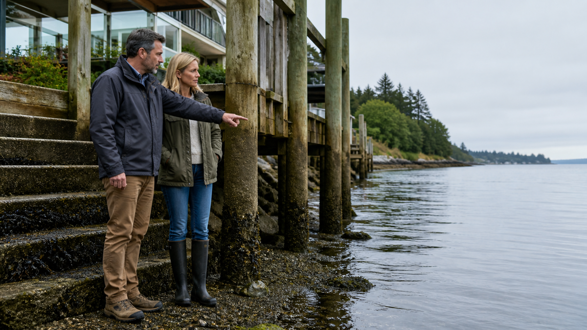
Evaluating shore access cannot be accomplished in a single thirty-minute property showing. To truly grasp how the shoreline behaves, observe the property at various stages of the tidal cycle. A dock that floats perfectly alongside a bulkheaded yard during the middle of the day might sit entirely on dry mud by late afternoon. If your primary goal is to have consistent water access for a small vessel, discovering this limitation after purchasing the home would be a significant disappointment. Schedule multiple viewings if possible, or arrange to drive by the area at different times of the day. Take detailed notes or photographs during each visit to document where the waterline sits relative to fixed structures like piers, seawalls, or property lines. This systematic approach is a cornerstone of thorough due diligence. Just as you would carefully evaluate contractors—similar to how home service buyers should compare local companies before making an offer—apply the same deliberate review to the natural features of the property. The dynamic nature of the shoreline requires patience and structured observation to fully understand.
Establishing an Observation Worksheet
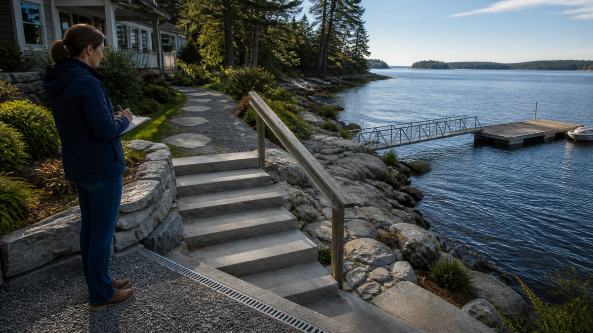
To keep your observations organized, create a dedicated shore-access due diligence worksheet for each property you visit. Start by recording the exact date and time of your visit. Next, note the apparent state of the water: is it rising, falling, or seemingly still? Document the condition of the shoreline itself. Is there a usable beach, a steep drop-off, exposed rocks, or deep mud? If the property includes a dock or a pier, measure or estimate the clearance between the bottom of the structure and the water surface, as well as the depth of the water at the end of the dock. Note any signs of recent high water, such as a distinct wrack line—a line of debris, seaweed, or driftwood left behind by the previous high water mark. This visual evidence can tell you a great deal about the typical reach of the water on the property. By standardizing the information you collect across different properties, you can make objective comparisons rather than relying on memory or the emotional impact of a single beautiful sunset view.
Contextualizing Observations with Predictions
While your physical observations are paramount, they become much more meaningful when paired with local data. By checking the predicted water levels for the exact time of your visit, you can understand where your observations fit within the broader daily cycle. For example, if the water seems alarmingly close to the edge of the lawn, checking the data might reveal that your visit coincided with a particularly high astronomical event, providing helpful context. Conversely, if the water is far from the dock and the prediction indicates only a moderate low, you know that the situation will be even more extreme during other times of the month. For those new to waterfront environments, learning how to read a tide chart is an essential skill that helps translate raw data into practical understanding. The predictions provide a baseline against which you can measure your on-site observations. Remember, the numbers you see on a standard table typically refer to a specific datum, or reference point, usually Mean Lower Low Water (MLLW) in many regions. Understanding this reference framework allows you to interpret the numbers correctly relative to the physical shoreline you are viewing.
Reference Stations and Local Variations
When utilizing prediction data to support your property evaluation, it is vital to recognize that the figures are generated for specific locations called reference stations. The property you are viewing might be located several miles away from the nearest station, nestled in a cove, or situated up a tidal river. As the water moves through these varied geographical features, the timing and the magnitude of the changes can be altered significantly. A high level at the mouth of an estuary might not translate to a high level miles upstream until an hour or more later. Therefore, buyers should look for subordinate station data—adjustments provided for specific locations relative to a primary reference station. Even with these adjustments, local topography, narrow channels, and broad shallow bays will modify the water’s behavior. Your on-site observations remain the ultimate ground truth. The printed predictions simply offer a theoretical framework to help you anticipate what might happen when you are not physically present to watch the water move.
Factoring Shoreline Dynamics into Purchase Decisions
The character of the shoreline should fundamentally influence your purchase decision, as it dictates how you will interact with the property on a daily basis. Unlike a dated interior that can be remodeled—perhaps by transforming your compact bathroom top design strategies for maximum space and functionality—the bathymetry and hydrology of your waterfront are permanent fixtures. You cannot cost-effectively change the depth of the water at the end of your pier or stop the natural cycle of the ocean. If the property’s natural rhythms do not support your intended lifestyle—whether that involves keeping a deep-draft sailboat, having a shallow-water access, or simply enjoying a consistent view of the water—it is better to discover this limitation during the due diligence phase rather than after closing. A thorough evaluation ensures that your expectations align with environmental realities, leading to a more satisfying long-term ownership experience.
Educational Resources for Buyers
To deepen your understanding of coastal dynamics before making a purchase, prospective buyers should consult authoritative resources. The NOAA Tides and Currents website is the premier source for official predictions and historical water level data across the United States. Exploring this site will give you information about the general characteristics of the region you are considering. Additionally, the NOAA Ocean Service Education portal offers excellent tutorials explaining the astronomical and physical forces driving coastal water movements. Understanding the science behind the daily cycles, including the effects of the moon and sun, and the concept of spring and neap cycles, will make you a more informed consumer. By combining robust field observations with foundational scientific knowledge and official data, waterfront home buyers can approach their purchase with complete confidence.
Frequently Asked Questions
Can I use a standard tide prediction to determine if a property will flood?
No. Standard predictions offer guidance based on astronomical cycles but do not account for weather, storm surge, or atmospheric pressure changes. They are not safety or flooding guarantees. Consult official FEMA flood maps and local authorities for flood risk assessment.
How many times should I visit a waterfront property before buying?
It is highly recommended to visit the property multiple times at different stages of the daily water cycle. Observing the shoreline at both the highest and lowest points of the day provides a complete picture of shore access and water depth.
Why does the water level at the property differ from the published tables?
Published tables are based on specific reference stations. The property may be located in a cove, bay, or river where local geography, narrow channels, and wind conditions can significantly alter the timing and height of the water compared to the main station.
What should I include on a shore-access observation worksheet?
Your worksheet should include the date and time of the visit, the apparent direction of water movement, the distance from the waterline to fixed structures like seawalls, the clearance under any docks, and the location of the debris wrack line on the shore.
Are tide charts useful for planning structural changes to a dock?
While they provide general baseline data regarding typical water levels, they do not replace prescriptive engineering or professional surveying. Any structural changes or marine construction should be evaluated and designed by licensed professionals familiar with local regulations and extreme weather risks.